
|
2653 miles long, surrounded by the Andes mountains and the Pacific Ocean, landscapes, wildlife, geography, climates, a traditional cuisine and 500 years
of history and culture since the first contacts between the Spanish colonizers and the indigenous peoples who inhabited the Chilean territory. |
|
Tourism industry development.
|
Since the last 15 years, Chile has developed a world-class tourism industry thanks to the joint work of the Government, tourism companies and local experts.
Chile brought out its cultural and gastronomic history and its natural beauty in front of the world, standing out and transforming itself into a new tourist power with its greatest strength concentrated in adventure tourism. Hospitality in Chile also evolved with large hotel projects, boutique hotels, lodges, ecological communities and thematic accommodations. The Chilean culinary menu was reinvented by mixing with the incomparable cuisines of Peru, Argentina, Spain, France, Italy, Japan and China, highlighting wines, pisco, seafood, meats and vegan menus. Chile has been awarded by important tourism companies worldwide as National Geographic, Lonely Planet and TripAdvisor, standing out for winning for 4 consecutive years (2015, 2016, 2017, 2018) the "World's Leading Adventure Tourism Destination" for the World Travel Awards thanks to its recognition and tourism excellence, beating the United States, Australia, Ecuador, Canada and New Zealand , among other countries. Source: https://www.worldtravelawards.com/ |
|
Adventures & Multisports.
|
Chile with all its geographical extension and diversity is a true territory of expeditions, adventures and multisports.
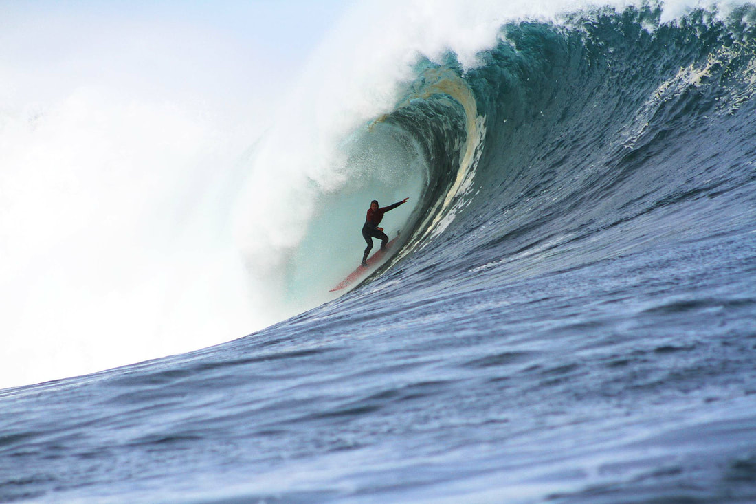
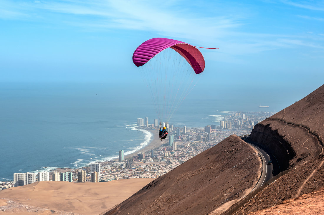
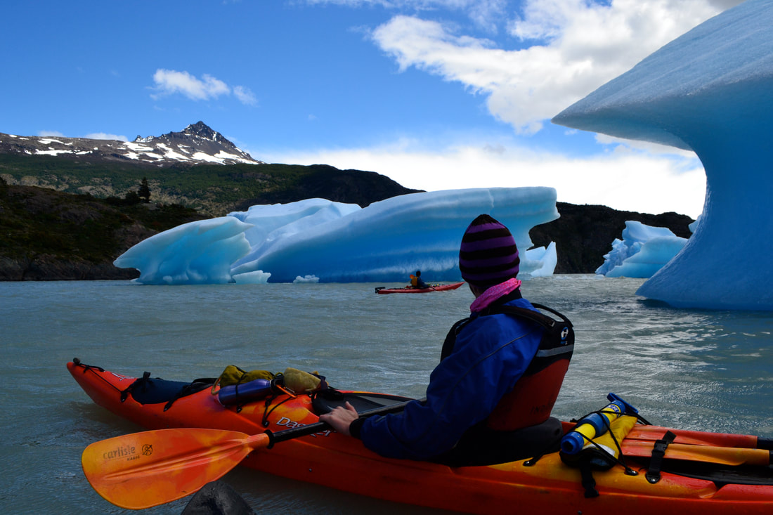
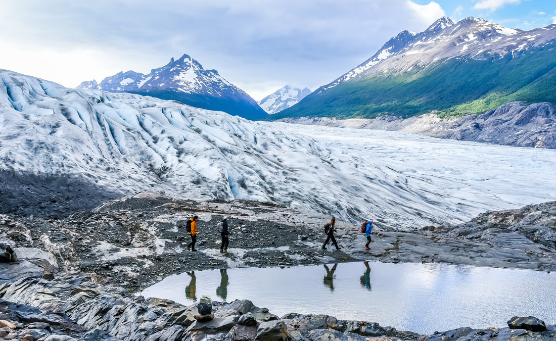
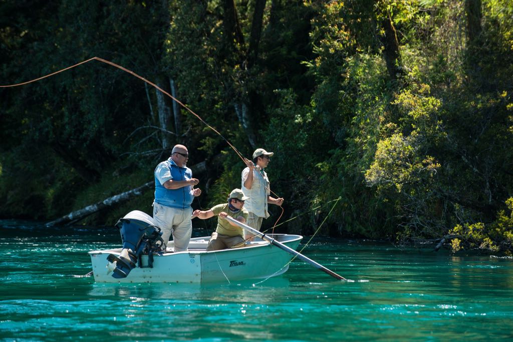
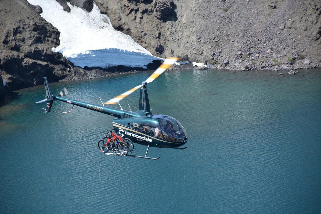
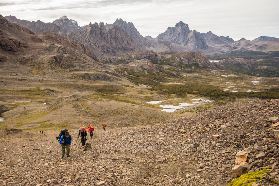
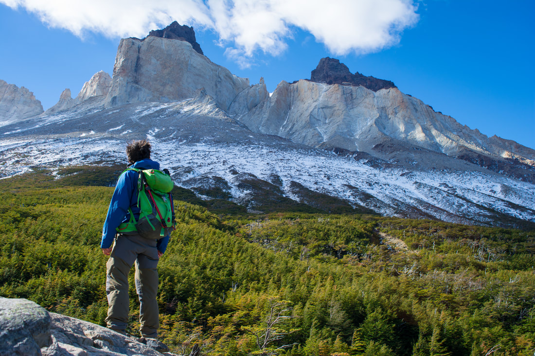
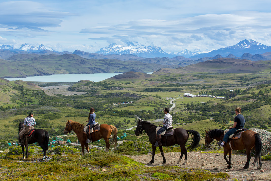
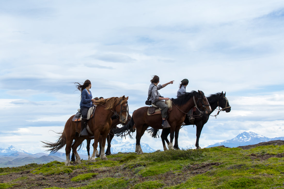
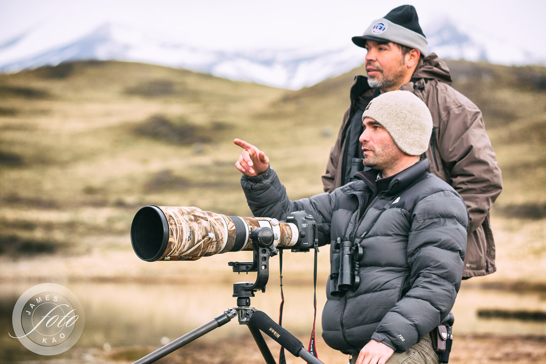
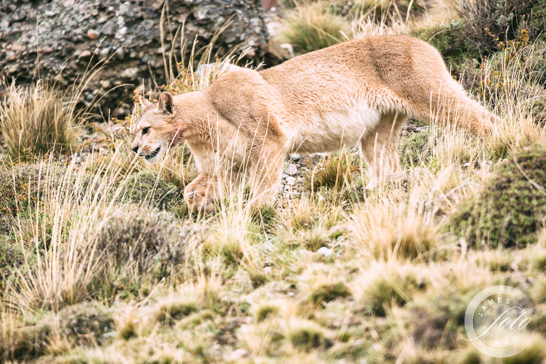
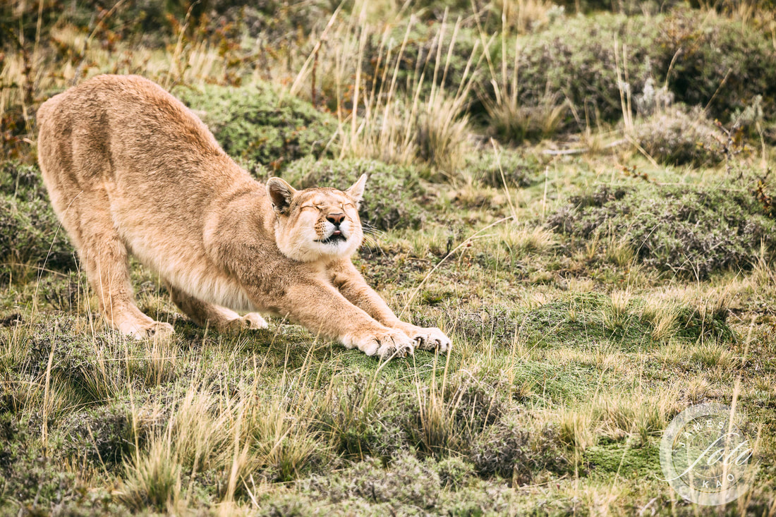
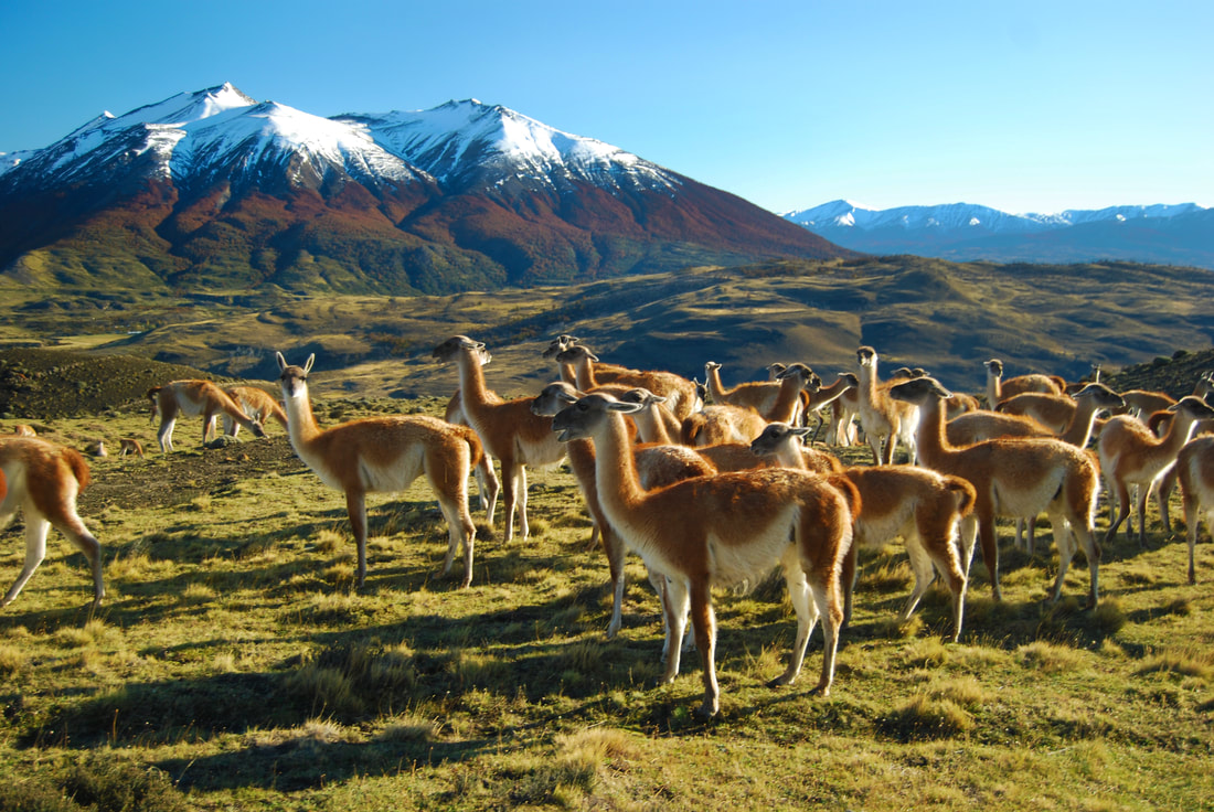
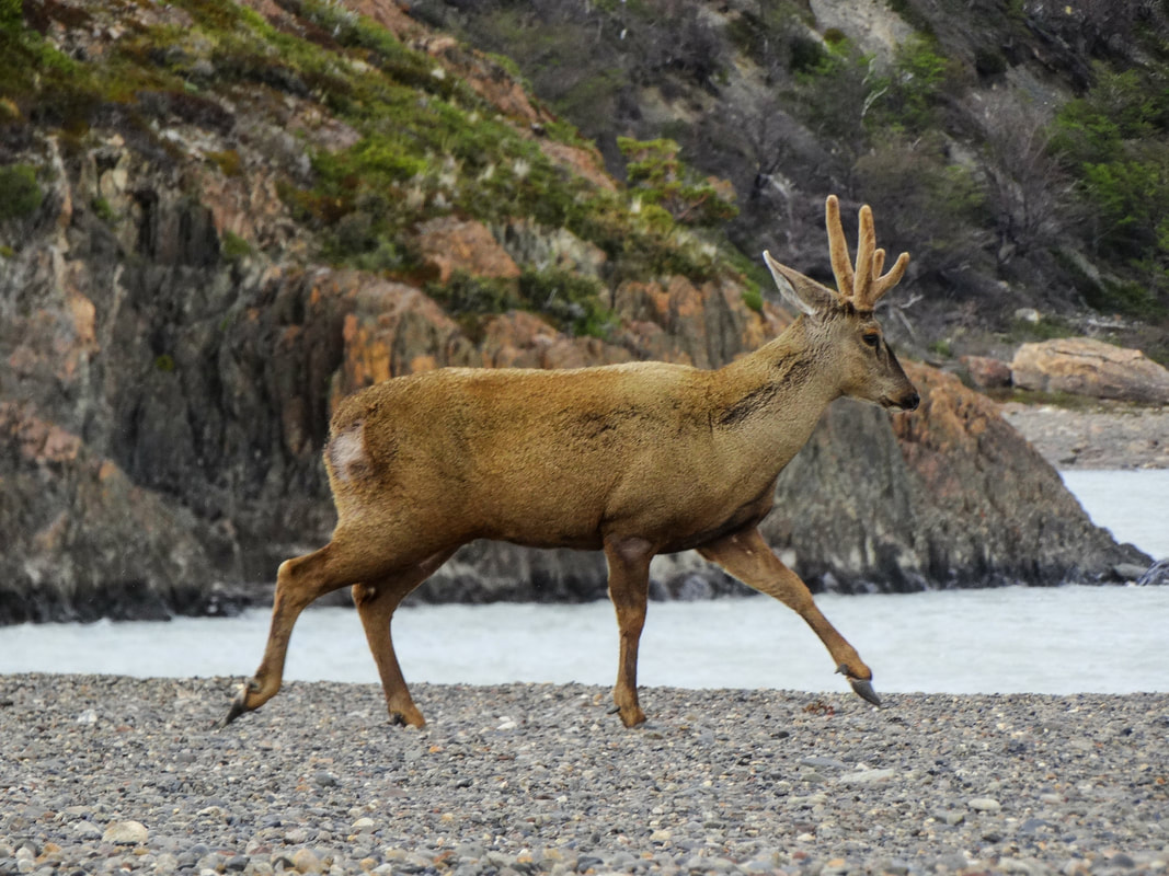
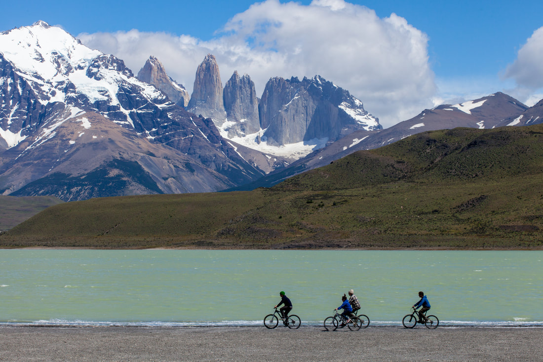
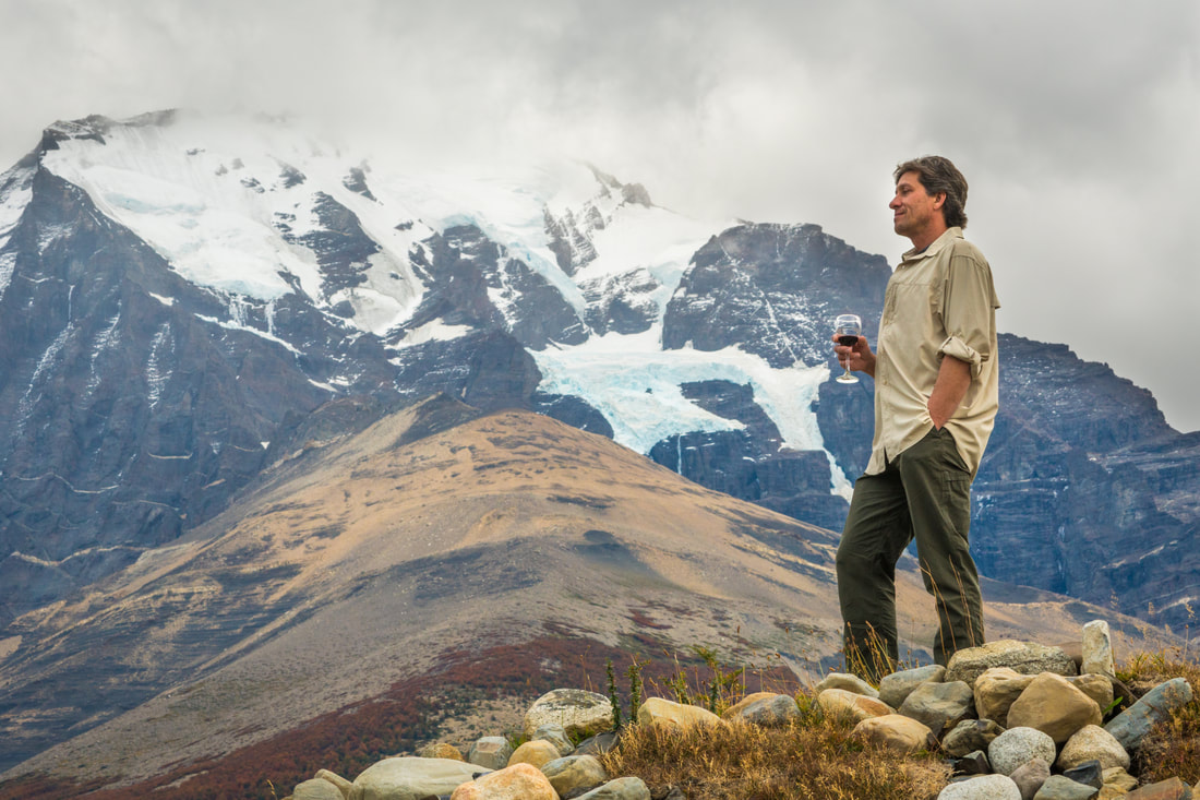
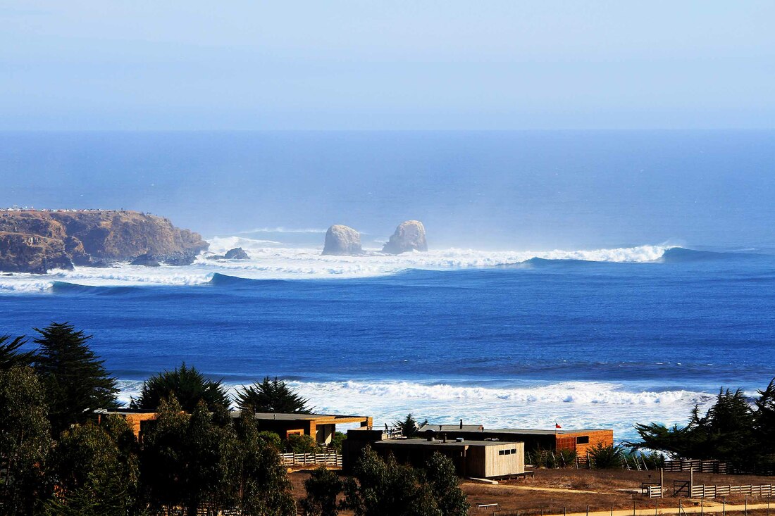
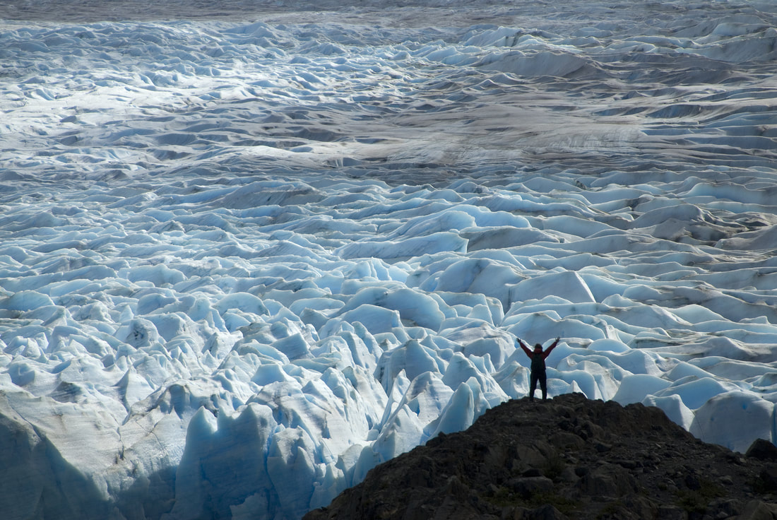
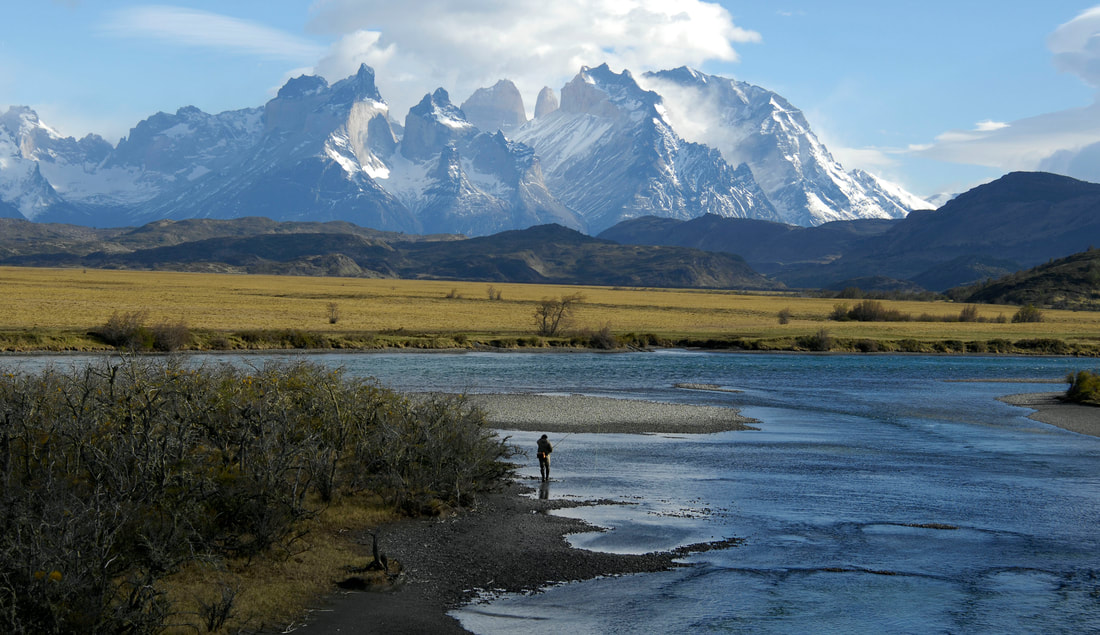
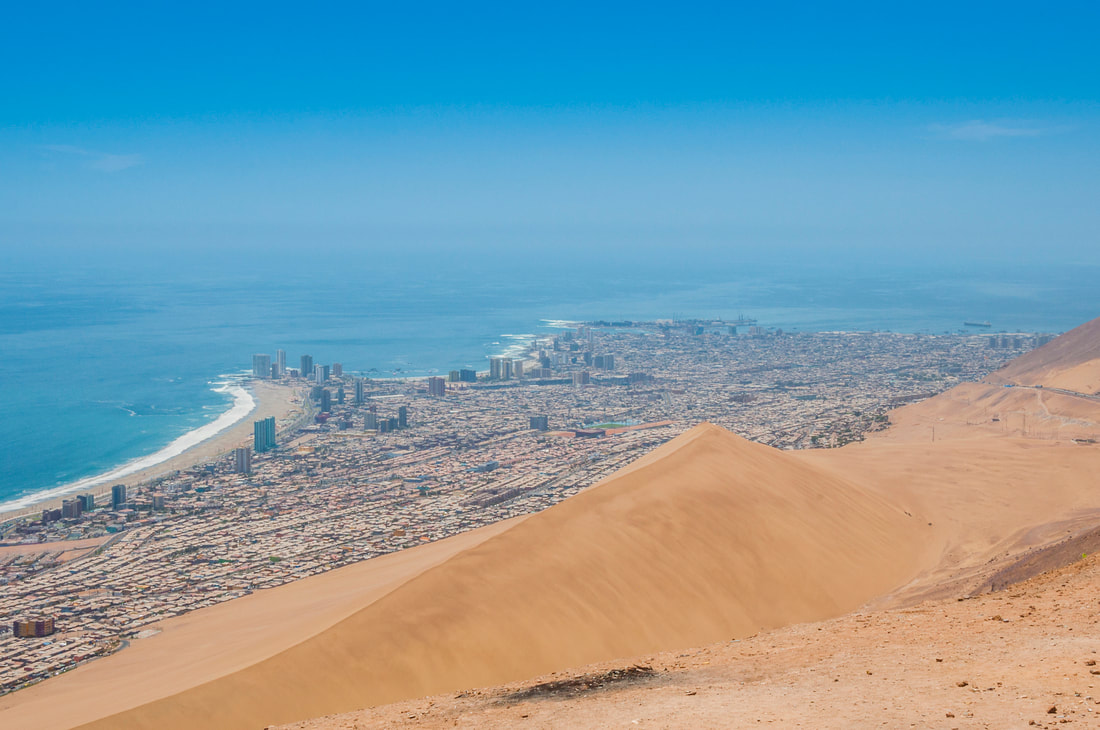
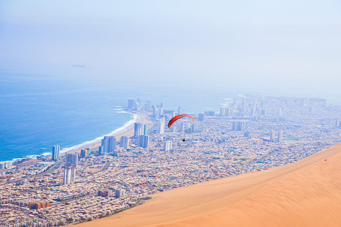
The most known activities in Chile are 1. Expeditions in the Southern Ice Fields in Patagonia, 2. Camping and excursions in the Tompkins Conservation Route of Parks. 3. Trekking in Torres del Paine National Park, 4. Hiking to the Alexander Selkirk Lookview - Robinson Crusoe Island. 5. Horseback riding in Patagonia or Easter Island, 6. Wildlife photo tracking (Pumas, condors, guanacos, ñandúes) in Torres del Paine, Patagonia, 7. Mountain bike in the Andes mountains. 8. Surfing in Punta de Lobos, Pichilemu, Puertecillo, Pichicuy, Arica, Iquique, Easter Island 9. Kitesurfing in Matanzas. 10. Stand-up-paddle in Pichilemu, Punta de Lobos or Zapallar. 11. Diving and free diving in Robinson Crusoe Island. 12. Fishing in Robinson Crusoe Island, Chiloé Island or Zapallar. 13. Fly-fishing in the Yelcho Lake, Patagonia. 14. Kayaking in Torres del Paine or Yelcho Lake in Patagonia. 15. Rafting in the Lakes District (Pucón lake area or Futaleufú river). 16. Sandboarding in The Dragon sands (Iquique) or in The Death Valley in San Pedro de Atacama. and of course fútbol (soccer) in Santiago. |
|


Landscapes.
|
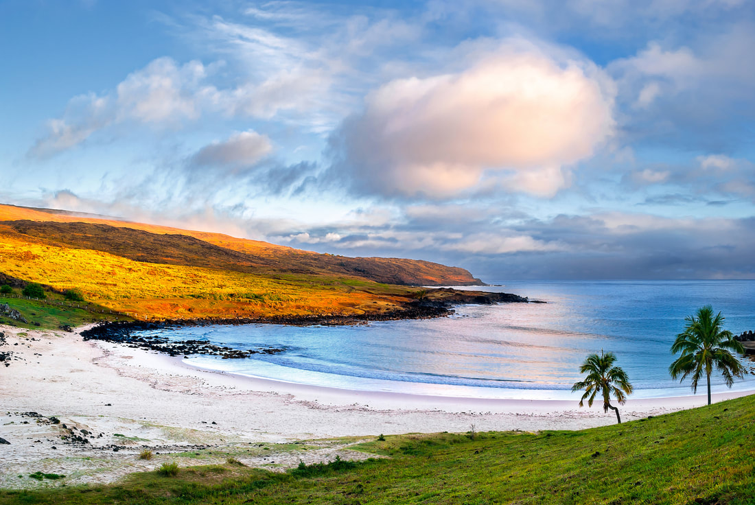
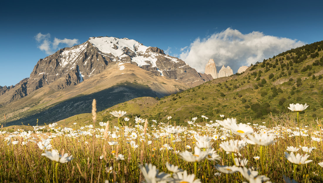
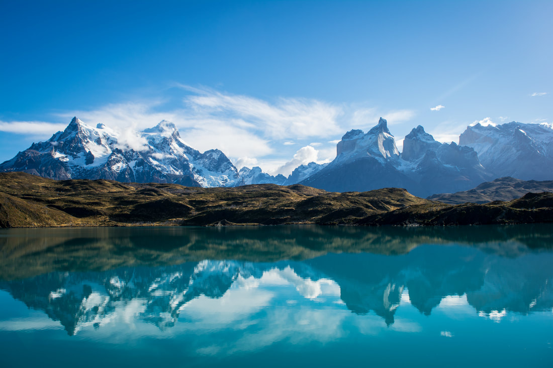
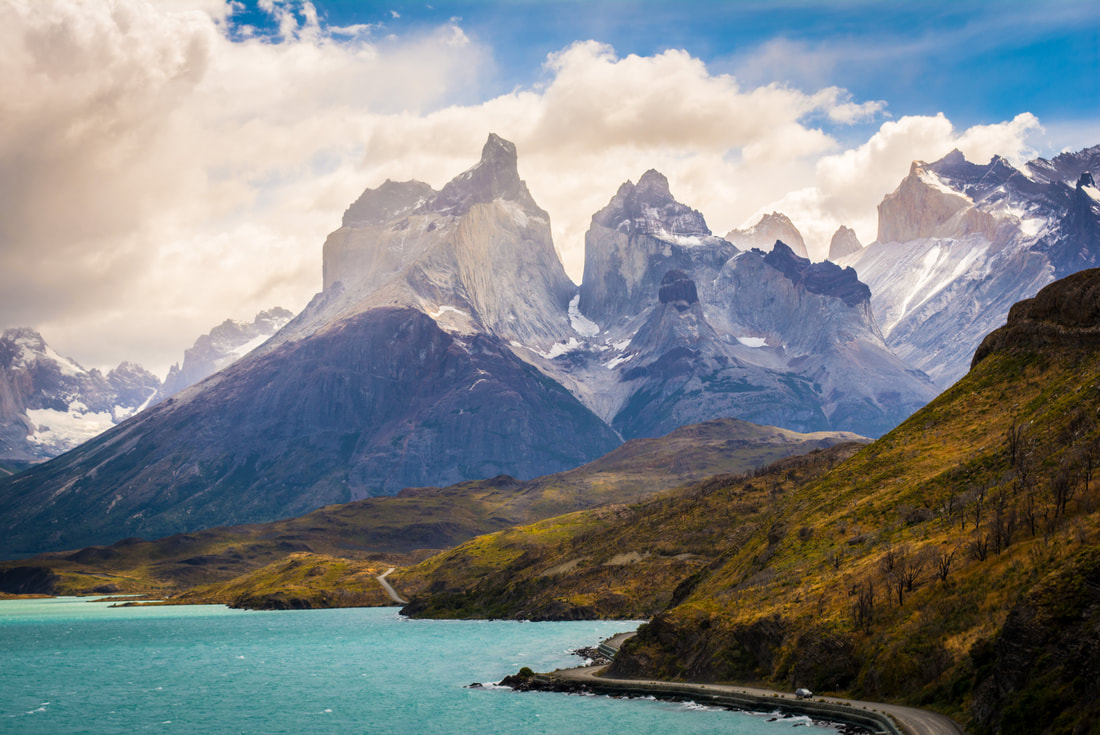
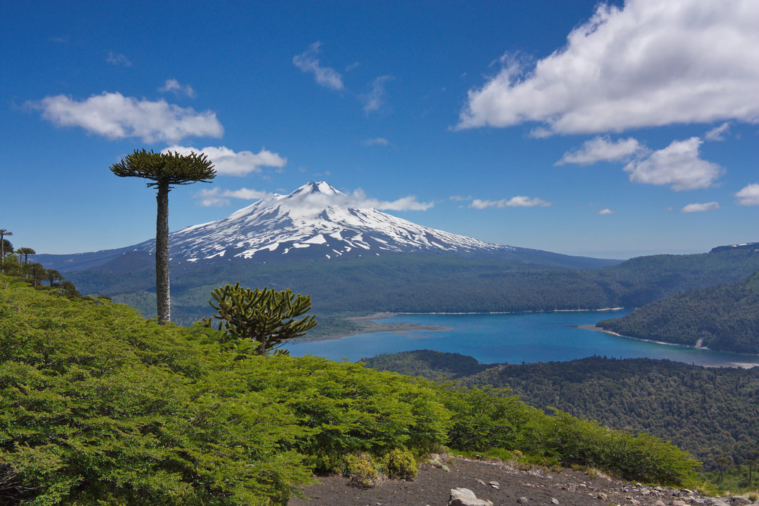
The landscapes of Chile are very varied, from the Atacama Desert, the beaches, the Andes mountain range, the central valleys, the big cities and ports, the vineyards, the forests, lakes, rivers and fjords, the massifs of Patagonia, glaciers, austral, tropical and temperate islands and Antarctica, are part of the different types of landscapes that you can find in Chile.
|
|


Geography.
|
The chilean territory has a particular geography as it is surrounded by the Andes Mountain Range and the Pacific Ocean.
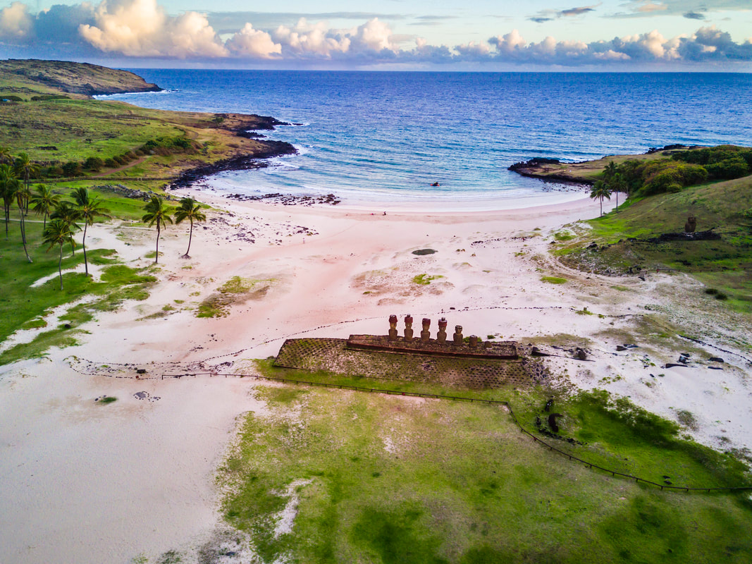
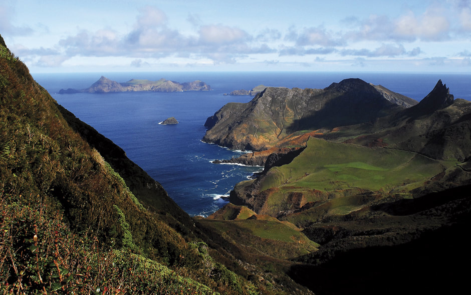
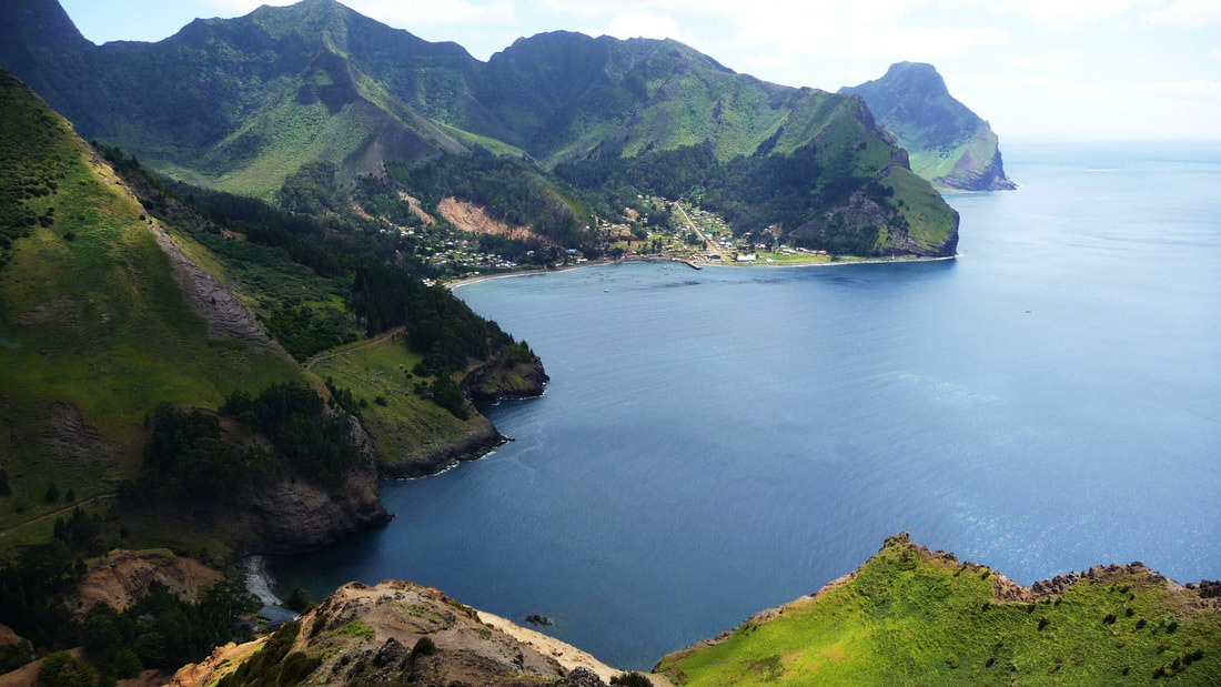
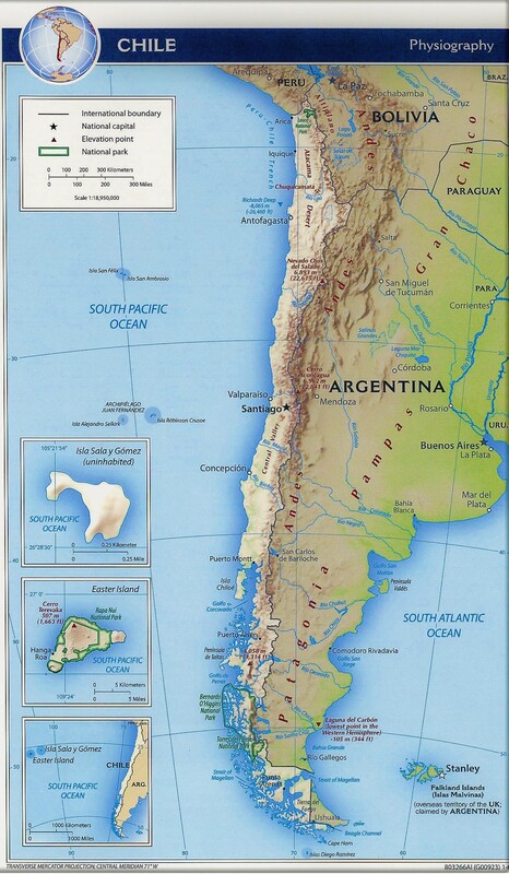
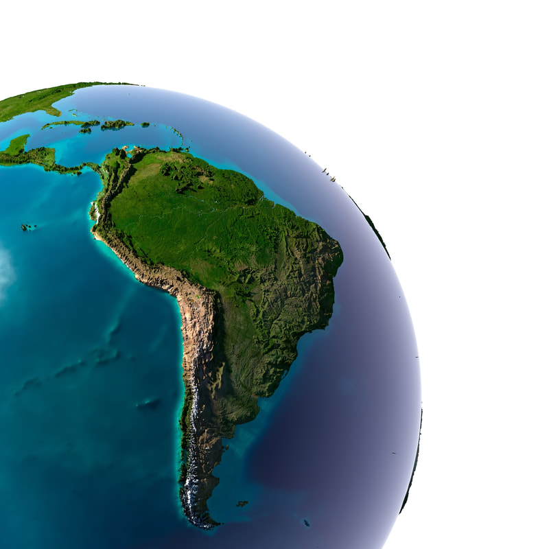
The Geography of Chile is divided into 3 categories: Continental, Insular and Antarctic. Continental: Chile is "isolated" from the rest of South America, and that gives it a very important advantage over all of its South American neighbors by having the second longest coast in South America (6435 km of coastline) after Brazil. But with the difference that Chile has access to the Pacific Ocean, which gives commercial importance to Asia, Australia, New Zealand and California. Chile has 909 beaches with access to the Pacific Ocean and in the inland lakes, which tremendously favors fishing, diving and water sports. The Andes mountain range is the natural border between Chile and Argentina, with 141 volcanoes (2nd largest volcanic chain in the world after Indonesia) and the highest mountains of the continent (Aconcagua,) with 18 ski centers spread from North to South . North of Chile has the Atacama Desert, highland lagoons, pre-Hispanic towns, beaches with turquoise waters, national parks and large cities such as San Pedro de Atacama, Arica, Iquique, Antofagasta, Calama and Copiapó among others. Central Chile We can find its Capital Santiago, Valparaíso, Viña del Mar, the top resorts such as Zapallar, Cachagua, Maitencillo, Reñaca, Algarrobo, Punta de Lobos. And the central valleys where the vines of Carmenere, Merlot, Cabernet Sauvignon, Pinot Noir, Chardonnay and Sauvignon Blanc are. Along with the production of avocado, squash, kiwis, grapes, nectarines, plums, cherries, strawberries, raspberries, blueberries and blackberries among others. South of Chile is where the Austral zone begins, one of the regions of the world with more forests, lakes, rivers, islands, volcanoes, fjords, glaciers and wildlife of the world. National parks, conservation and natural reserves, a tourist and hotel development of first line, in German-style lake-cities thanks to the German immigration in the 19th century. Chilean Patagonia The area where Fernando de Magallanes entered to tour Cape Horn and Tierra del Fuego, discovering the most dramatic and diverse landscapes in the world. Where 3739 islands and 2180 islets are concentrated. Together with the Ice Fields, the glaciers, and the most beautiful mountain massifs of the continent, so colossal that they impede the passage of most of the rivers towards the Pacific Ocean, diverting them towards the Atlantic Ocean. A true geographical struggle between mountains, ice, islands, rivers, lakes and oceans. Insular: Chile insular is a scattered set of small islands and archipelagos of volcanic origin in the South Pacific, far from South America, which are territories under the sovereignty of Chile: the Juan Fernández archipelago and the Desventuradas islands form the so-called «insular continental Chile», while Salas y Gómez Island and Easter Island, both geographically located in Polynesia, form the so-called "insular oceanic Chile". All island Chile, administratively depends on the Region of Valparaiso. The Sporadic islands are not the only Chilean island territories; rather just 328 km², about 0.3%, corresponds to this heterogeneous set, the rest being a total of 3739 islands and 2180 islets, whose surface area reaches 105 561 km², about 14% of the area under effective Chilean control , part of what in Chile's official policy distinguishes "Chile insular" from "continental Chile," which corresponds to the territory of the country in South America and its adjacent islands. Easter Island, Rapa Nui, located 3600 km west of Caldera, which has an area of 163.6 km², being the main one of the Sporadic islands. Juan Fernandez archipelago, located 670 km of distance to the west of Valparaíso composed by the islands Robinson Crusoe, Alejandro Selkirk and Santa Clara. Desventuradas Islands, More than 800 km away from the mainland, in front of the Atacama Region, are composed of the San Ambrosio and San Felix islands. Salas y Gómez Island located 3220km west of Chañaral and 415 km northeast of Rapa Nui. Antarctic: At 1,250 kilometers from Punta Arenas, and separated only by 990 kilometers from Continental Chile, Antarctica is majestic as a great white lady. The riches that it possesses are guarded with great zeal because they could be the last resort in the distant future. Meanwhile, a group of Chileans give life there to Villa Las Estrellas, an incredible town, the only permanent human settlement in the Chilean Antarctic Territory, where remoteness is not synonymous with isolation. The surface of the Chilean Antarctic is 1,250,000 square kilometers, which has very fragmented coasts limited by: - The Larsen Ice Barrier, the Weddell Sea and the Vega, Seymour, Ross, Cerro Nevado and Robertson Islands and all the lands that extend southwards from the meridian 53º west. - North, there are Piloto Pardo, Clarence, Dundee, Joinville and D'Urville islands. - Northwest, are the South Shetland Islands, which group the islands of King George, Nelson, Robert, Greenwich, Livingston, Deception and Snow. To the west, there is the Bellingshausen sea, and lands that extend south to the 90º west meridian, with the Smith, Palmer, Low, Trinidad, Bravante, Anvers, Renaud, Serrano, Biscoe, Adelaida, Alejandro and Charcot islands. - The great peninsula Tierra de O'Higgins, with its islands and islets near it, which is actually the continuation of the Andes mountain range, called "Antartandes". Chile has a total area of 756,626 km2 From north to south it has a length of 4,300 km and a width whose average is 177 km. It extends to the west and southwest of South America; It borders Peru to the north, Bolivia and Argentina to the east, and the Pacific Ocean to the south and west. |
|

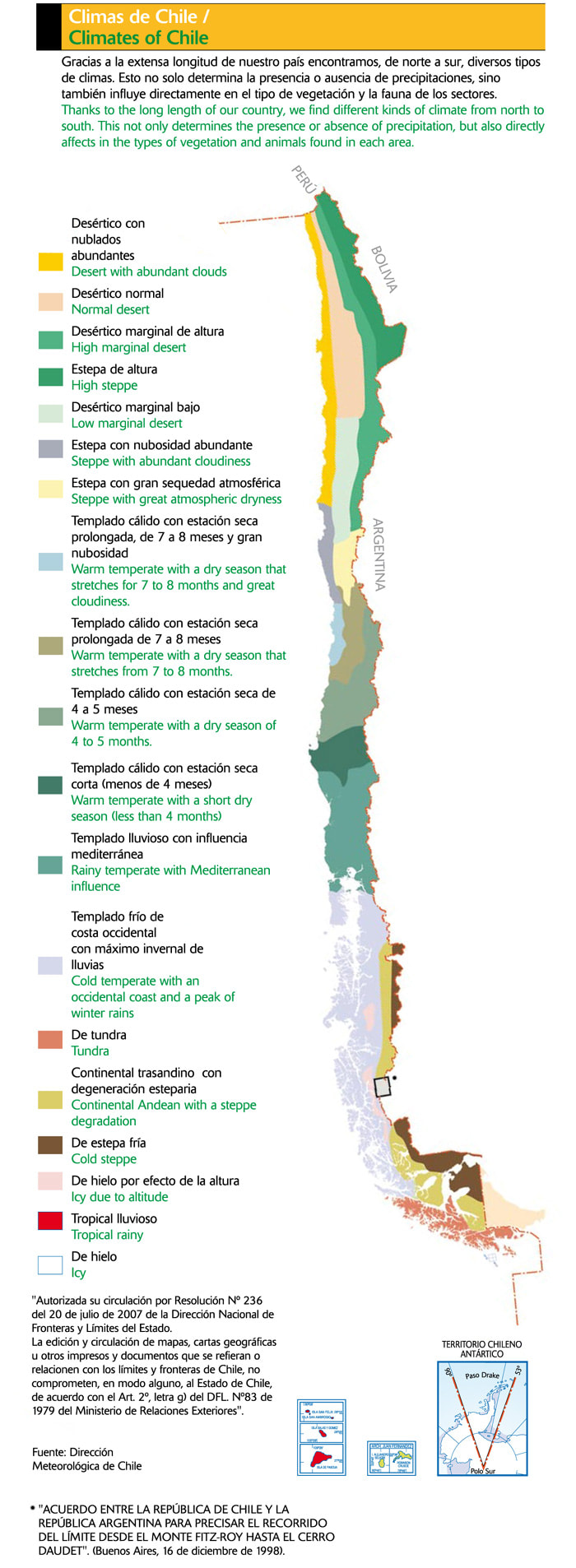
Climates.
|
The climate of Chile comprises a wide range of conditions across a large geographic scale that extends for almost 40 degrees of latitude (and almost 73 degrees if we consider the claimed Chilean Antarctic Territory). Generalizing, when analyzing the different territories of the geography of Chile, the north has a drier climate with relatively high temperatures, while the south has a cooler and more humid climate. Precipitation is more frequent during the winter months. In addition, mention should be made of the tropical rainy climate of Easter Island, the maritime climate of the Juan Fernández archipelago and the polar climate of the Chilean Antarctic Territory.
North: In general terms it has an arid climate, which is subdivided into four types: Coastal desert: In this area there is a large number of days with abundant clouds: it extends along the coast from the north to almost the latitude 30 ° south, in a longitudinal strip not exceeding 40 km wide. Normal desert: It extends almost parallel to the coast in what corresponds to the intermediate depression, from the north end to the height of Chañaral. Desert height: It is located towards the east, in the altiplano and the Andean basins, it is characterized by low temperatures and by rainfall in summer (high plateau winter). Low marginal desert: Corresponds to the desert type of lesser significance, occurs in the Atacama Region and is characterized by the presence of rains in winter. Central Chile: In the historical center of the country, which could be called geographic center-north, between 32 and 38 degrees of latitude approximately, a type of Mediterranean climate predominates, characterized by a winter rainy period and a dry season in summer. On the coast temperate temperatures are maintained in general, with humidity in the air, materializing in low clouds, and sea breeze. The proximity of the ocean moderates the temperatures. Summer is not excessively hot and winter is softer than inside. There is no snow and frost is rare, the day-night oscillation is also lower. South: From Temuco to the South a more humid climate is observed, with frequent rains and cooler temperatures. In this temperate climate, the forests become more leafy, and highlight the presence of several national parks. In Valdivia the rains become much stronger, reaching 2,593 mm per year. The cold increases as it continues south. Also the humidity increases, due to the near presence of the Pacific Ocean. This southern zone of Chile is typically of the so-called oceanic climate or also known as humid temperate (rainfall throughout the year), even in the summer months, naming temperate summer and cool summer. The exceptions are the highest mountainous areas, with cold climates, tundra and polar for the height of the Andes, the easternmost areas of Chilean Patagonia, with steppe climates, and the extreme south, with isothermal Tundra climate. Patagonia: From the Taitao peninsula the oceanic climate becomes colder, with an average temperature higher than 10 ° C in the Summer. This strip of the Pacific coast extends close to the western mouth of the Strait of Magellan, (where the climate of isothermal tundra begins) and is the rainiest area of the country reaching more than 4,000 mm annual rainfall. Also in the central part of the Magallanes Region, the area of Punta Arenas, the climate is similar with the difference that here the rainfall is much smaller due to the effect of the Andes mountain range that traps a large part of the moisture coming from the West. Winter snowfalls are frequent. Antarctica: In the Chilean Antarctic Territory, low temperatures are constant, generally reaching less than 0°C. Except for the coast, the air is very dry. The side that faces towards the west and the northwest (towards the sea of Bellinghausen and the Drake pass) receives more oceanic influence, therefore the temperatures are softer, not getting to be extremely low. The northernmost coastal areas on this side, such as the northwest of the Antarctic Peninsula, South Shetland Islands, Palmer Archipelago, Biscoe Islands, etc., have a subpolar or tundra climate, with an average temperature of the warmest month exceeding 0°C, therefore there are uncovered lands of permanent ice sheet, it is this sector that has the highest concentration of research bases of the entire Antarctic. The upper parts of this sector, however, present a polar ice climate, generally covered by glaciers, which reach the sea and cover most of this sector anyway. The eastern side, which faces the Weddell Sea, on the other hand, is more continental, with winter temperatures much lower, and the average temperature of no month reaching 0°C, corresponding to the polar ice climate. The precipitations of this territory are relatively scarce and they are diminishing toward the South Pole, where the "polar desert" reigns. The entire interior of the territory is under the regime of polar ice climate, with monthly average temperatures below 0°C all year round. Insular: Easter Island. The island has a tropical climate and is the only place in Chile where a tropical climate prevails, its thermal regime shows in all its magnitude the oceanic influence: low thermal oscillation both daily and annually, and rainfall, meanwhile, are distributed regularly throughout the year. These are of convective origin, particularly in the summer season. During the winter, the presence of some systems of low pressures brings with it precipitations of frontal origin. The average annual temperature is 21.8°C reaching its maximum of 24.6°C in January and the minimum of 19.2°C during August, typical of the subtropical climate, so in general the winters and summers are temperate . Rainfall is distributed throughout the year, without falling below 90mm or exceeding 150mm per month, with a slight rise during the months of April and May. The rains are sporadic and brief, and their waters are quickly absorbed by the soil, so there are no fluvial channels or large aquifer reserves, except for the lakes in the volcanic craters. The climate of Easter Island is strongly influenced by the nearby cold Humboldt current and the winds coming from Antarctica. Juan Fernandez Archipelago (Robinson Crusoe, Alexander Selkirk, Santa Clara islands). Subtropical maritime climate, with high environmental humidity, and the annual average temperature is 15.3 ° C. The average annual precipitation reaches 1,041.5 mm; the rains decrease between October and February. Los Andes mountain range: The temperature decreases as you ascend in altitude. In the altiplano the climate is dry, but not as much as in the desert, due to the presence of summer rainfall called Bolivian winter, of Amazonian influence. It is a steppe-type climate and tundra due to the height effect. The highest peaks have glaciers (eternal snow). Towards the center-north zone it becomes colder and more humid, with presence of scrub and dry forest, increasing the glaciers. From the 35th parallel approximately the Andean foothills become definitely humid, supporting lush forests, the level of the eternal snow continues to fall. This humid and cold climate maintains the enormous fields of North ice and South Patagonian ice field. Arriving at the southern end of the territory, the permanently cold and windy climate of the Andes only gives rise to vegetation of mosses and lichens and eternal snow, that is, the climates of tundra and polar due to the effect of height. Seasons in Chile: Most of the country lies within the zone of "temperate" latitudes of the southern hemisphere, where the stations are most clearly manifested. The dates are approximate and are determined by the solstices and equinoxes: Summer: December 21 (solstice) to March 20 (equinox). Autumn: March 20 (equinox) to June 21 (solstice). Winter: June 21 (solstice) to September 23 (equinox). Spring: September 23 (equinox) to December 21 (solstice). |
|
Chile's Tourism history.
|
9,000 b.C. Atacama - The atacameños people appear that extended through the Altiplano and the Atacama Desert.
IV - V A.C. Easter Island - The first Polynesians arrive to inhabit the Island. It is said that they came from the current Marquesas Islands in French Polynesia. 1450 - The atacameños people are conquered by the Incas. 1520 - Patagonia - The first encounter between the white man and the original peoples takes place, when the Spaniard Fernando de Magallanes (who entered Chile through the Strait of Magellan, now Patagonia) saw a large indigenous people who he described as giants and named them Patagones, its large footsteps, thus giving rise to the name Patagonia and the legend of land of giants. The Indians who saw Magellan were Aonikenk who averaged 1.80 meters. The name Patagon is derived from the Pathagon character of a cavalry book that Magellan was fond of. These inhabitants were bands of nomadic hunters, who entered when the ice of the last glaciation was retreating. Known for their great stature they occupied the steppes from the Santa Cruz River in Argentina, to the North, to the Strait of Magellan, to the South. One of the great changes that the Europeans brought to America was the horse, an animal that drastically modified the way of life of all the Indians. But the great change in their culture was due to the foreign penetration of their lands. With the colonization process and the creation of ranches, the colonists and Aonikenk began to use the same territories and, little by little, the indigenous people were forced to move towards Argentina. The Pali area Aike was the last place in Chilean Patagonia that registered the presence of these aborigines. The Sélknam occupied the steppe of the north and the forests of the south of Tierra del Fuego (The island owes its name to the large bonfires made by the Indians, who were sighted in the distance by Ferdinand Magellan.) Their way of life was similar to that of the Aonikenk, but they never used the horse; They were tall and stocky, but somewhat more aggressive than other aborigines. 1556 - The Spanish Empire conquers the Incas and all of Atacama. 1663 - Tourism in Chile "began" when the Franciscan Order was authorized to build a Hospice in the San Francisco ravine in the city of Valparaíso, known as "Little San Francisco", because of its geographical and architectural resemblance to the city of San Francisco, California. 1686 - The British pirate Edward Davis arrives at Easter Island, being the first European to disembark. He named "Land of Davis". 1722 - On Sunday, April 5, the Dutchman Jakob Roggereen arrives on Easter Island, who names it "Easter Island" for disembarking on that date. Explored the island for 1 week. 1750 - In Downtown Santiago there was already the "Posada de Santo Domingo" and at the same time the "Posada del Corregidor" was being built. 1840 - Was created the Pacific Steam Navigation Company that favored the arrival of tourists by boats to Valparaiso from cities around the World such as New York, Liverpool, Bordeaux, Vigo, Lisbon, Rio de Janeiro, Buenos Aires, Montevideo, Callao, Guayaquil, Panama City, Havana and Bahamas among others. 1881 - Until this year there was little contact between the white man and the Indians, but on this date the Chilean - Argentine limits were established and the colonization of the island began. Soon the cattle colonizers arrived and important estancias were formed. It was there when the real problems began for the Selk'nam (who were one of the largest native peoples of Patagonia). It should be considered that their culture did not know or understand private property and, therefore, considered hunting sheep natural, whose hunting facility was noticed almost immediately by the Indians. To fight the robberies, the estancieros began to put fences and installed sheds with permanent surveillance. Even so, the assaults did not diminish and a kind of genocide of this town began that led to its total extermination. In this way the Selk'nam were either killed or deported. In addition to banishing them from their ancestral lands, contact with the whites brought inactivity, modified their habits, changed their physical vigor and spread different diseases. The missionaries did their best to save the races of Tierra del Fuego, but they did nothing but delay their extinction. They also inhabited this austral territory the maritime hunters, Kawéskar and Yámanas (most austral ethnic group of the world). The Kawéskar were distributed from the Strait of Magellan to the north and the Yámanas to the south, mainly in the area of Puerto Williams and the Beagle Channel. It is worth noting that the Yámanas were the ones who inspired Charles Darwin to write the theory of evolution, due to his ability to survive with little clothes in one of the coldest areas in the world. The former became extinct due to diseases, especially venereal diseases, the alcohol introduced by the workers and the migrations that dispersed them. The epidemics drastically reduced the Yámana population and the last survivors of the ethnic group took refuge in Navarino Island, in a property donated by the Chilean government. The last representative of this ethnic group is Cristina Calderón, who currently lives in Villa Ukika, near Puerto Williams. 1888 - The Captain of the Chilean Navy, Policarpo Toro achieves the treaty of sovereignty with the Rapanui people to annex Easter Island to Chile. 1929 - Began the manufacture of automobiles in Chile, which favored the transport of passengers. Well-known brands such as Citroën, Ford, Fiat, Peugeot, Renault, Mini and General Motors assembled their cars in Santiago, Arica and Rancagua. 1960 - The Government of Jorge Alessandri created La Dirección del Turismo, (English: The Tourism Department) which later became in 1975 the current Sernatur (Spanish: Servicio Nacional de Turismo). This succeeded in creating a government department responsible for managing and developing tourism in all regions of Chile, creating national parks, reserves and nominations to declare world heritage sites and biosphere reserves to UNESCO. 1967 - Santiago - Arturo Merino Benítez International Airport (AMB) opens. 1982-1983 - Were published a series of tourist guides called "Bancosorno Guide", elaborated by Jorge Sánchez Reyes and that became the base of "Turistel", guide launched in 1985. 1985 - Tourism in the Chilean Antarctic received a boost when the Chilean Air Force and the Sernatur began a series of trips to the white continent, while the Hosteria de la Villa Las Estrellas (which had been built in 1980) was renamed «Estrella Polar Hotel», managed by the Cabo de Hornos Hotel in Punta Arenas (Chilean Patagonia). 1990 - The administration of the President Patricio Aylwin builds more than 2,500 kilometers of highways of international level, highlighting the Pan-American Highway that runs from Arica to the Big Island of Chiloé. In addition to routes 5 and 68 that connect Santiago with Valparaíso, Viña del Mar and all the spas of the central coast of Chile, preferred destinations for Chileans and Argentines in Summer and holidays. 1995 - Easter Island, Rapa Nui National Park is declared a World Heritage Site by UNESCO. 1996 - 11 Wine routes are created in Chile. North to South: Elqui Valley Route - Limarí Valley Route - Aconcagua Valley Route - Casablanca Valley Route - San Antonio Valley Route - Maipo Valley Route - Cachapoal Valley Route - Colchagua Valley Route - Curicó Valley Route - Valle del Maule Route - Itata Valley Route. 2000 - The 16 wooden churches of Chiloé are declared a World Heritage Site by UNESCO. 2003 - The Historic District of Valparaíso is declared a World Heritage Site by UNESCO. 2005 - Former saltpeter Humberstone offices are declared a World Heritage Site by UNESCO 2006 - The Sewell mining town is declared a World Heritage Site by UNESCO 2008 - Chile swims in the largest pool in the World. The hotel complex San Alfonso del Mar, in the area of Algarrobo, opens the 250,000 cubic meter saltwater pool and one kilometer long and enters the 'Guinness Records'. 2012 - National Geographic highlighted in the Fifth place the Central Market of Santiago within its list of culinary destinations worldwide. 2014 - Magazine Selling Travel awarded Chile the prize for "Breakthrough Destination" in the "Agents' Travel Choice Awards" contest, where more than 600 English travel agencies voted. 2017 - The Daily Telegraph chose Chile as the "best destination to visit in 2017". 2018 - Lonely Planet highlighted Chile as "the first of the ten countries to visit". |
Economy.
|
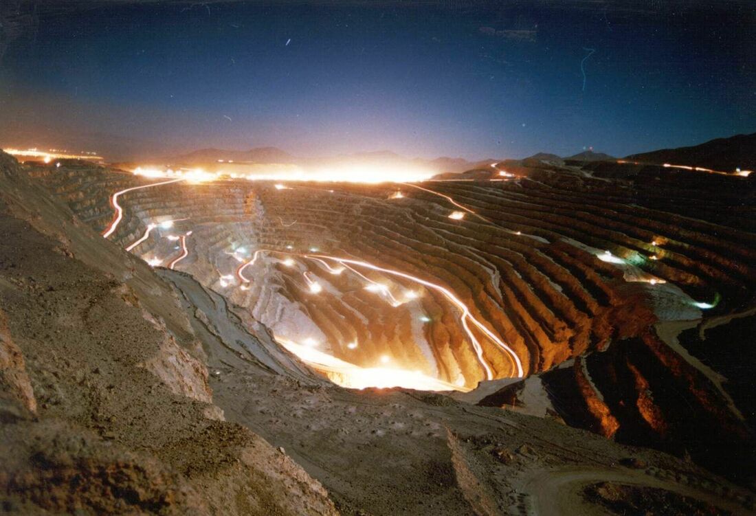
Chile works two great sources of natural wealth: the sea and the land.
The great length of its coastline and the richness of its waters has favored the development of the fishing industry. For its part, the Chilean subsoil contains important reserves of metallic minerals, copper being the most important for the national economy. Chuquicamata is the largest open pit mine in the world, located in Atacama, it has been the main source of copper extraction since 1882. |
|
"There is no better way to promote a country than when a person knew that country, was well treated, enjoyed, enriched, enlightened, because it is the best spokesman and the best ambassador to attract more people,".
President Sebastián Piñera.
President Sebastián Piñera.