
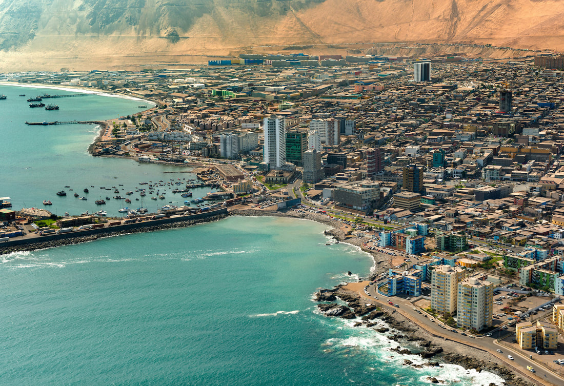
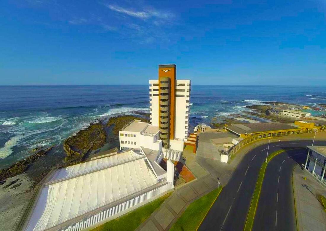
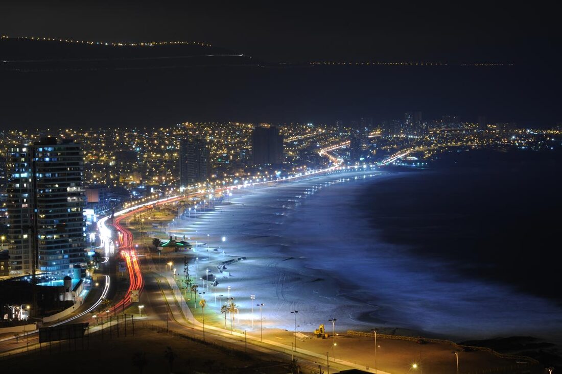
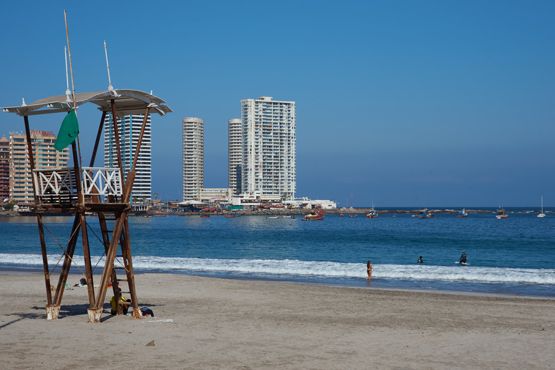
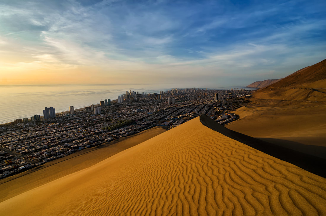
Iquique
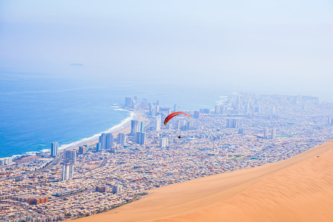
Iquique is the capital of the Tarapacá region, a historic city due to the War of the Pacific, the former saltpeter offices of Humberstone, its location close to different national parks, and because it has some of the best beaches for international big wave surf competitions, besides paragliding, sandboarding and trekking.
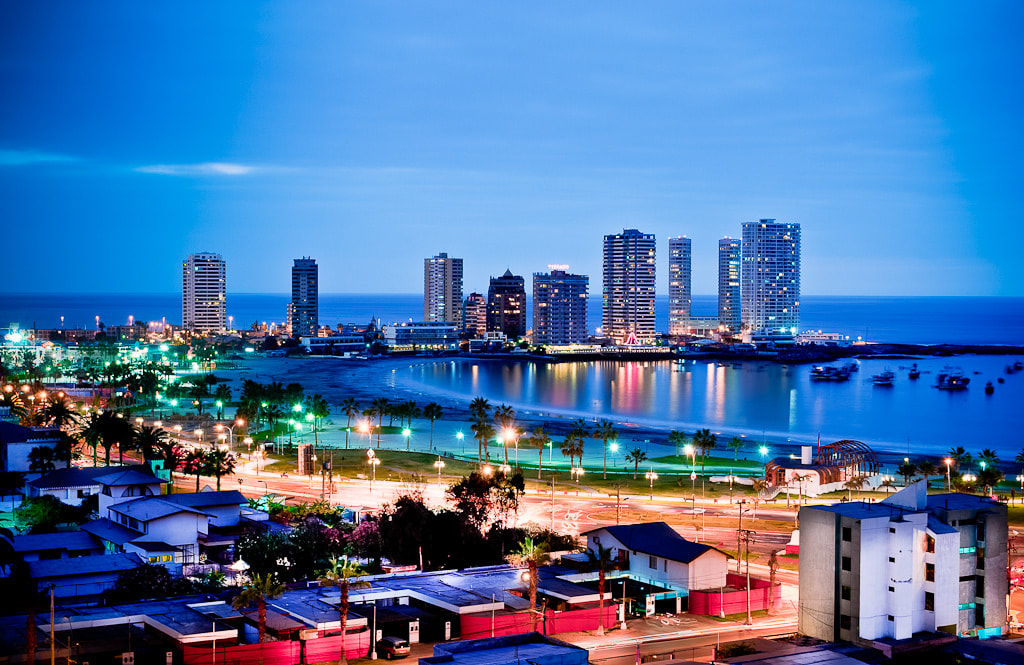
Casino and nightlife included, and then finish enjoying its beaches with delicious seafood and pisco sours.
Casino and nightlife included, and then finish enjoying its beaches with delicious seafood and pisco sours.
|
|
|
Founded in the 16th century, Iquique was part of the Viceroyalty of Peru as much of South America was at the time, and remained part of Peruvian territory until the end of the 19th Century (Chile took over Iquique in the Pacific War 1879 - 1883).
Iquique's early development was due in large part to the discovery of mineral riches, particularly the presence of large deposits of sodium nitrate in the Atacama Desert (then part of Peruvian territory).
In July 1835, Charles Darwin, during his voyage on the Beagle, traveled to Iquique and described it as a town "very much in want of everyday necessities, such as water and firewood". These necessities had to be brought in from considerable distances. Darwin also visited the saltpeterworks.
Territorial disputes between Bolivia and Chile triggered the War of the Pacific in 1879. The Battle of Iquique was fought in the harbor of Iquique on May 21, 1879, now commemorated as Navy Day, an annual public holiday in Chile. The outcome of the war gave Chile this portion of the Peruvian territory.
Over the years there was substantial emigration from other parts of Chile to this area which was called the Norte Grande (Great North) In subsequent years the further exportation of Chilean saltpeter (mainly to European countries) significantly helped in the development of the city, attracting foreigners and rapidly expanding housing projects.
Duty-free Iquique has one of the largest duty-free commercial port centers of South America, the Zona Franca of Iquique (free zone of Iquique) which has been traditionally called Zofri. There are around 2.4 square kilometres (0.93 sq mi) of warehouses, banking branches, and restaurants.
Copper mining, mainly in Quebrada Blanca, Cerro Colorado, and Doña Inés de Collahuasí, is also an important industry in Iquique.
Hotels in Iquique

Touristic places
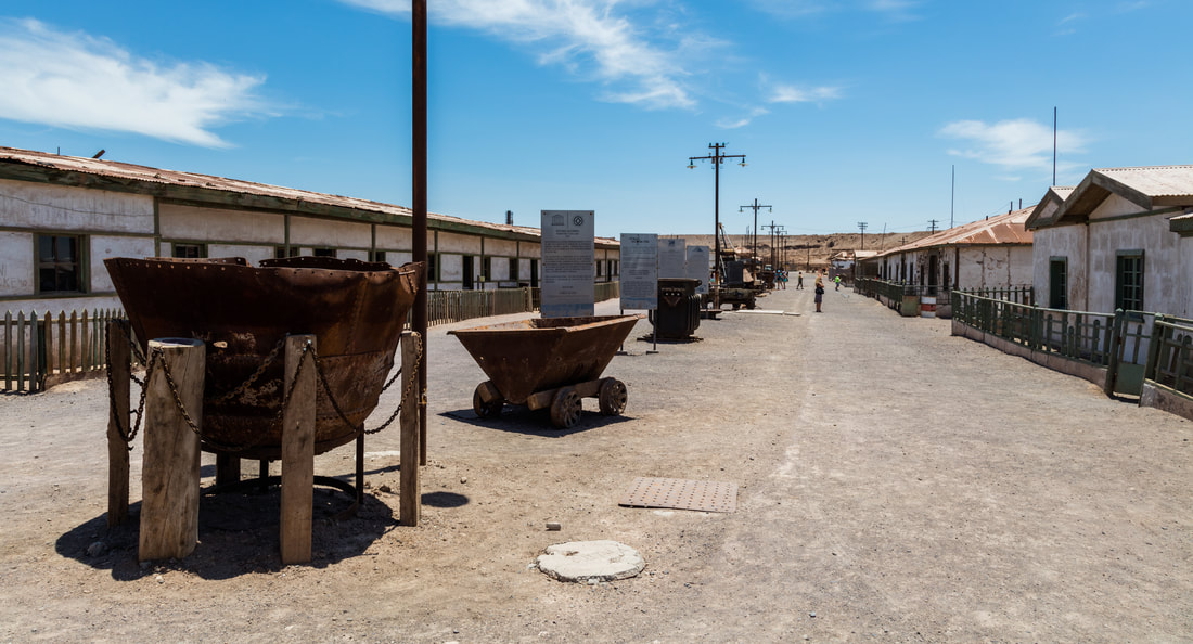
Humberstone former saltpeter offices.
|
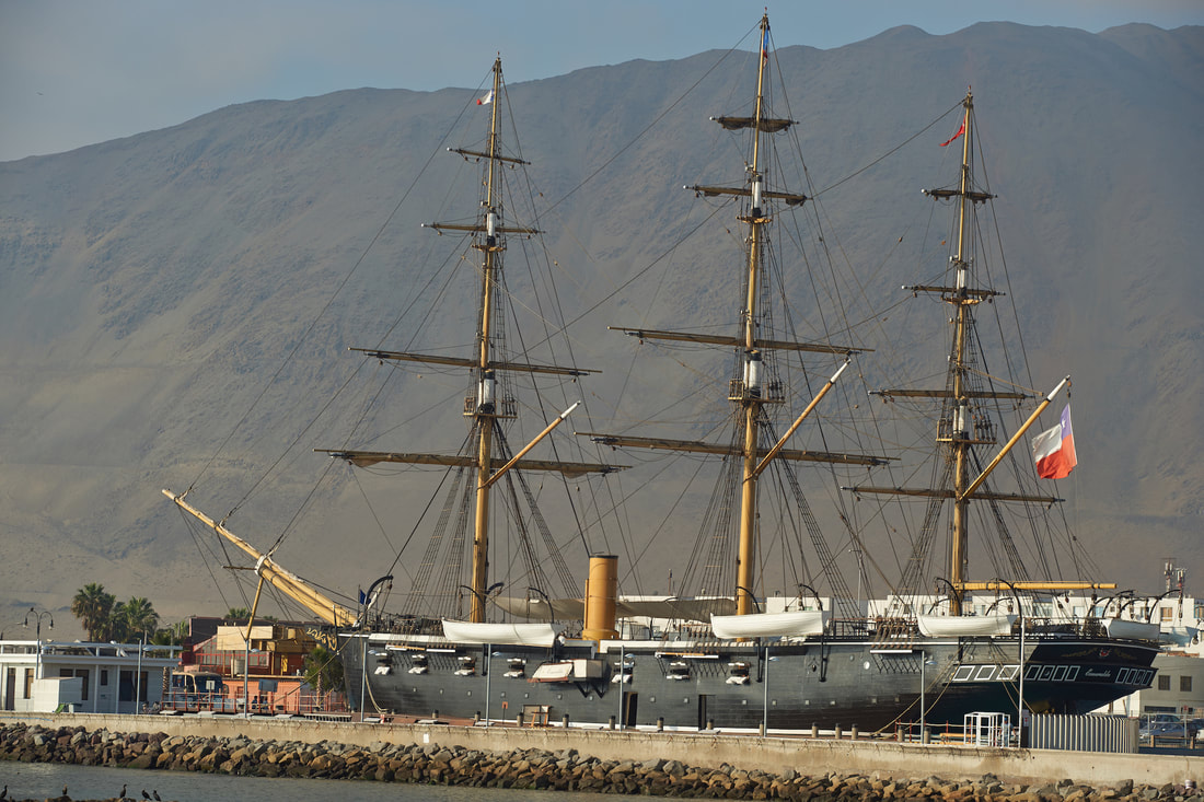
La Esmeralda battleship.
|
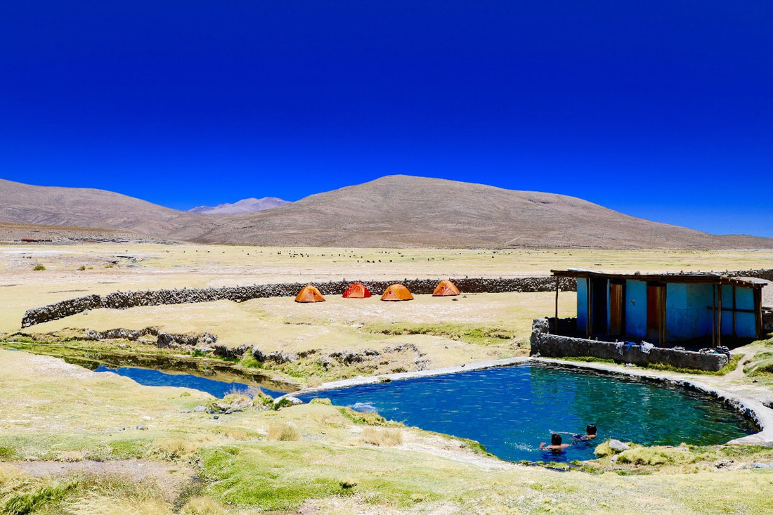
Isluga Volcano National Park (Altiplano).
|
|
|
|
TRAVEL PACKAGES
SOON.
More places to visit in Atacama Desert.
San Pedro de Atacama.
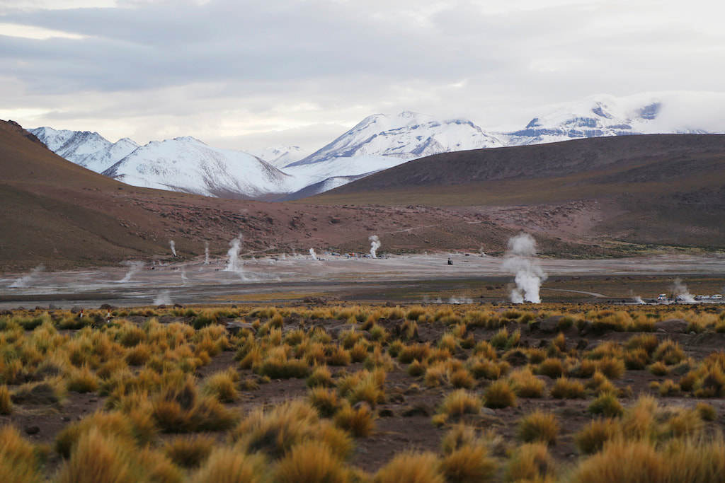
Atacama salt flates, the high plateau lagoons, Flamencos National Reserve, El Tatio geysers, The Death Valley, The Moon Valley, The ALMA Observatory are waiting for you!
|
|
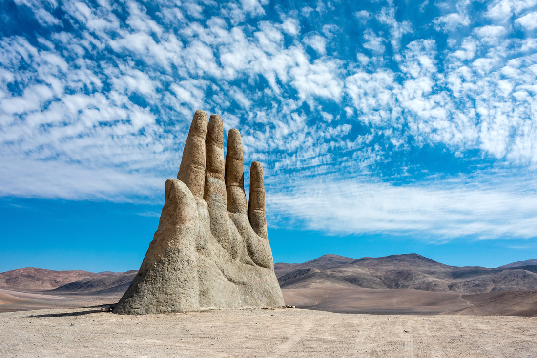
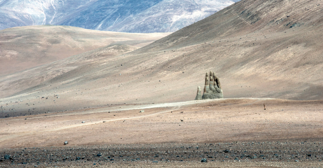
La Mano del Desierto (Antofagasta).
The Hand of the Desert is a high-sculpture (36 ft) of iron and concrete built in 1992 by the Chilean artist Mario Irarrázabal.
Symbol of Human Sorrow, it shows how small, vulnerable and helpless humans are.
It is located 60km from the city of Antofagasta along the Route 5 Pan-American Highway.
Symbol of Human Sorrow, it shows how small, vulnerable and helpless humans are.
It is located 60km from the city of Antofagasta along the Route 5 Pan-American Highway.
|
|
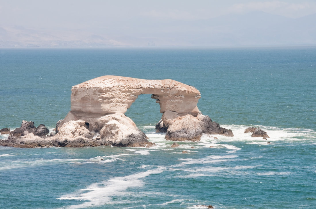
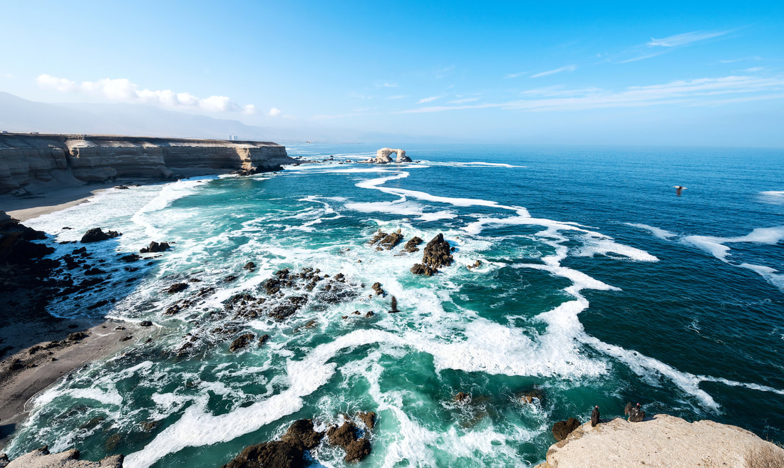
La Portada, Antofagasta (The Gateway).
It is a natural monument with an area of 31.27 ha, which highlights the maritime accident of sedimentary rocks and fossil remains in the shape of an arch.
|
|
The arch is 43 meters high, 23 meters wide and 70 meters long. It has a base of black andesite volcanic stone, on which the marine sedimentary rocks, strata of yellowish sandstone and the layers of fossil remains of shells (from 35 to 2 million years BC) were arranged. All this was molded during a long process of marine erosion.
The arch is surrounded by the cliffs of the coastal cliff, whose maximum height is 52 masl, which were also molded by marine abrasion.
Located 18 km north of the city of Antofagasta, which can be accessed by the route B-446, a road connected to kilometer 15 of route 1 (currently Autopistas de Antofagasta). This access road of 2 km leads to the upper terrace arranged in the unit, which has parking, viewpoints, restaurant and art exhibitions.
La Portada has two hiking trails:
Trail 1: An upper trail of 70 m, located at 50 m altitude on the upper terrace. This road has access for people with disabilities and lasts 10 minutes on foot. It connects with the Mirador Museum of Biodiversity.
Trail 2: A path with stairs that allows access to the beach. This road does not have access for people with disabilities and lasts 40 min.